Living Archives of Everyday Knowledge and Stories:
Darebin Parklands and Surroundings

Darebin Parklands Bluestone quarry history sign Photo taken: 2023/11/11 Photo Credit: YL

Darebin Parklands remaining bluestone quarry faces Photo taken:2024/03/18 Photo Credit: YL

Uncle Reg's stone - founder of the Darebin Parklands Spiritual Healing Trail in 2003 Photo taken: 2024/03/18 Photo Credit: unknown
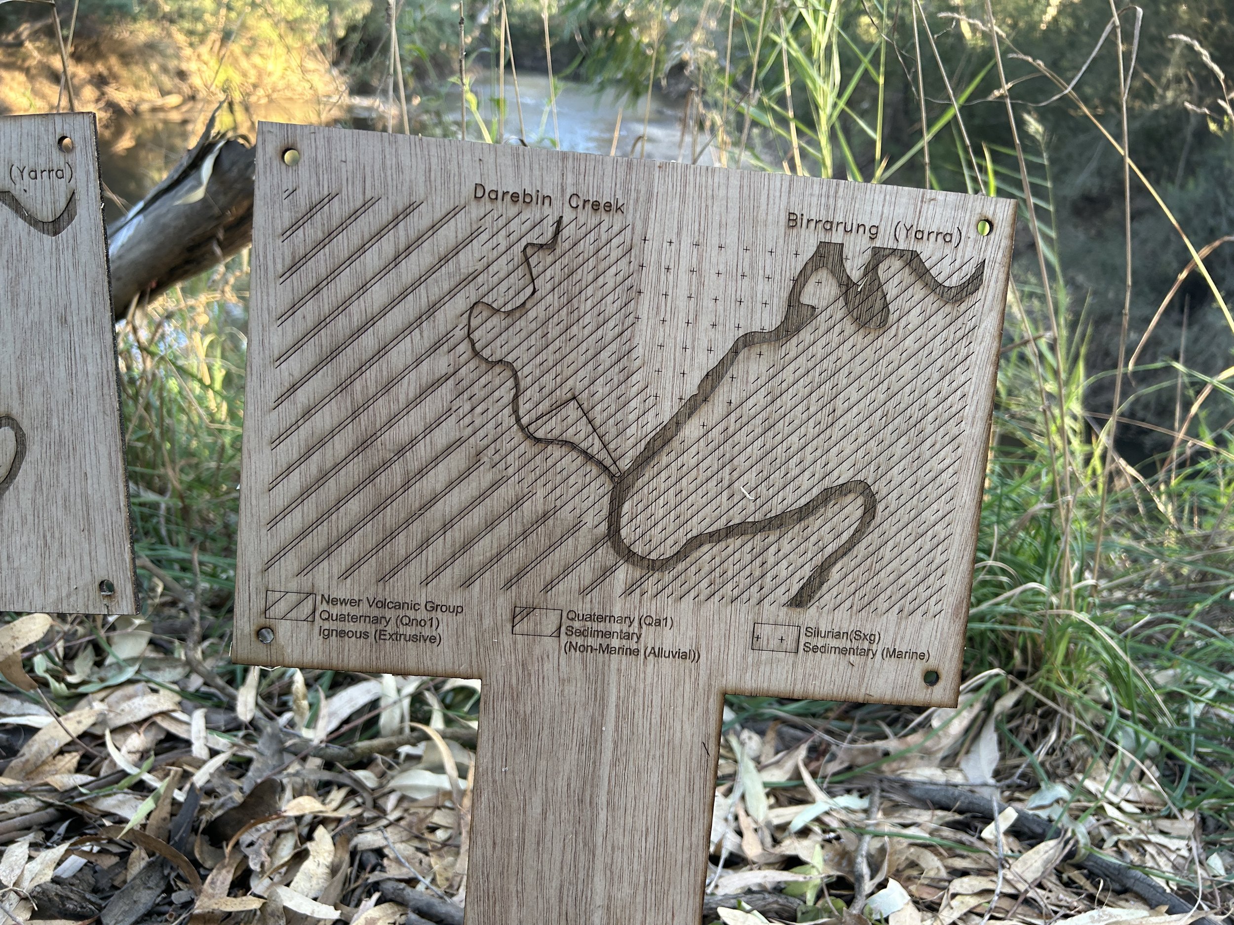
Darebin Creek's Confluence and its Geology Mapping

Darebin Creek Confluence Map at Open House Open Floodplain Event

Darebin Creek's Confluence

Tip Water Treatment The treatment system collects ground water (leachate) from beneath the tip site to prevent it entering the Darebin Creek, and then aerates it and strips heavy metals and excess nutrients from the water through a system of bio-filters. This water is then pumped through a bio-swale, and out into three wetlands before being recirculated. Credit: DCMC

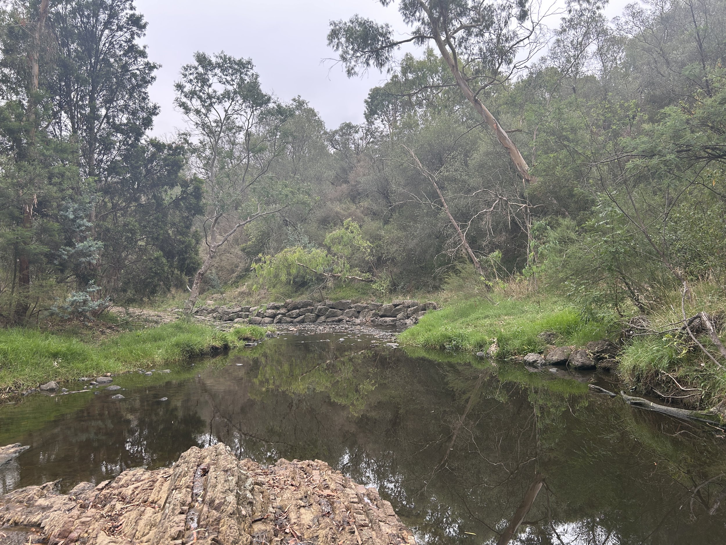
Silurian Outcrop There are several significant outcrops of sedimentary rock throughout the park originating from the Silurian period. In ancient seas, 430 million years ago, fine mud and sand sediments were laid down horizontally and slowly developed into rock. Eventually pressure under the earth pushed these rocks to the surface resulting in the dramatically different land form on the Ivanhoe side, as compared to the volcanic Alphington side. Credit: DCMC

Steppingstones Credit: Elaine

Bluestone BBQ Building Credit: Elaine

Credit: Elaine

Credit: Elaine

Credit: Elaine

Credit: Elaine

A stacked rock formation lines the bank, likely for erosion control. A narrow dirt path leads up an embankment covered in dense vegetation, including trees with silver-green leaves and some with broken branches. The scene reflects a semi-natural riparian landscape, shaped by both natural processes and human intervention. Dog walkers walk the hidden track almost buried by the plants. Credit: anonymous

Bridge on Darebin Creek Credit: anonymous

Wetland at Darebin Parklands – With my eyes closed, the sounds of diverse species flow through me. Credit: anonymous

A section of Darebin Creek where the water level is very low, it seems only 10-20 cm deep and even as if people can walk straight though. Credit: anonymous

A very popular and beloved crossing - walking across with the sound of water flow, very refreshing. Credit: anonymous

A Timber table take looks like stone table. Credit: anonymous

Mossy bedrock, stacked creekside stones, and a winding gravel path lead to a small stone bridge, where water flows over smooth, time-worn rocks. Credit: anonymous

An interesting mix of rock formations but it is hard to tell what’s natural and what’s constructed. Credit: anonymous
Looking downstream from the footbridge. Credit: anonymous

Looking at Darebin Creek at the bank. Credit: anonymous

Looking at the old quarry and current wetland. Credit: anonymous

A walking art-based workshop at Darebin Parklands. Credit: Yuqian Lin